|
| The iconic view of Machu Piccu. |
Time had come for another adventure. This time Shelly and I decided to visit Peru and walk the "Inca Trail" to Machu Picchu. We were inspired by our friend Deb's accounts of her trek, and of course by the fame and history of this spot.
I undertook all the logistics of this trip, booking flights and the trek and our lodging. It was quite an undertaking, I appreciate travel agents' efforts now.
The flight would take us from SFO to Panama City, then to Lima and ultimately, Cusco. I was a little concerned about the short layover in Panama City, (40 minutes!), but that was not a problem! Seems the hub in Panama is designed for international connections. We did not have to clear any customs or security, and as it turned out, our connection was in the gate adjacent to the one we arrived in!
Arriving in Cusco, we had expected a representative from our tour guides to meet us, but no such luck. People were very helpful though, and we got a taxi to our hotel easily enough. But this didn't inspire a lot of confidence in our guides!
Anyway, we checked into our hotel, and although the exterior looked a little rough, the hotel is actually pretty nice! El Balcon is a very old Spanish Colonial building which has been rebuilt into a hotel. Some pretty steep stairs though, and we did notice that it seemed to take a lot of effort to go up them. Cusco is at 12,000 feet, and you can definitely feel it!
 |
| Here's our hotel, El Balcon. Not fancy but nice, and a good location. |
Our room was comfortable and quite large! We had a nice view of the city from it. Actually, I was very happy with our stay at El Balcon, the service was very good, the beds comfortable, and a nice breakfast was served, all included in the room's modest price.
That first evening we walked to a small cafe for dinner; Shelly had chicken and I tried the alpaca! Alpaca was served skewered and grilled and is actually pretty tasty, a little like lamb. Wine is cheap in Peru!
Unfortunately, the altitude did affect our sleeping quite a bit. The first couple of nights, I was feeling out of breath all the time. I'd take a few normal breaths, then I'd have to take and extra big one because I felt I was out of breath! I eventually got somewhat used to it and was able to sleep by the end of our stay, but Shelly never could and by the end of the trip, she was simply exhausted from the lack of sleep.
Click here to see our Peru web album.
 |
| The view from our room. |
The next morning we got up and had our breakfast at the hotel. The coffee was served as a liquid concentrate to which you'd add hot water. We had eggs cooked to order every day, along with yogurt and cereal and toast and fruit. Coca tea was also offered to help fend off the effects of the high altitude.
We then struck out and toured the old part of town. The Plaza de Armas was the focal point, lined by numerous shops and restaurants and churches. Here we met a street vendor who was selling paintings and who was also quite an excellent guide, describing many places in the area that he thought we should visit. Nice guy and a good salesman, we bought a painting from him. We wandered around town for a while, finding a wonderful market place where we bought some coca leaves for the hike, just in case. They're really inexpensive. I also bought a coca taffee candy, which came in handy.
 |
| Plaza de Armaz |
That evening we finally made contact with a guide from Tierra Vivas, the outfit which we were trekking with. He ran down most of the things we needed to know and told us to be ready early next morning. We filled our packs for the trek then went to town for dinner and to get some cash. It was election time in Peru and there was some sort of demonstration starting up as we looked for an ATM. We were a little concerned about the crowd but we eventually found an ATM that was in a quiet area and got our cash. Our dinner was in a restaurant that overlooked the Plaza de Armas, so we watched the demonstration circle the plaza while we ate.
Early the next day our guide, K.J., picked us up and off we went. We were with the only other couple on our trek. Nice folks from Slovenia, "Alex" and Ursha. The bus ride was a fairly long one, leading from Cusco to a point known as "Kilometer 82". It started out through the less picturesque portions of Cusco, quite a lot of poverty there. After about an hour of driving through the Sacred Valley, we stopped for breakfast and had a chance to chat with Alex and Ursha, as well as a Canadian couple who we would encounter again during the trek. Indeed, like the Camino de Santiago, you keep running into people again and again as you pass through the trail.
Finally, we came to Ollantaytampo, a bustling place where we picked up our porters. Our bus suddenly got very crowded. For the four of us, the would be 8 porters, 1 lead porter, 1 cook, 1 assistant cook, and 1 guide! I was trying to compute how much I'd have to tip all these guys! Now we headed for our jumping off point, KM 82, on a very narrow, rough dirt road. A couple of times our van had to stop and back up to allow oncoming traffic through!
 |
| Ollantaytambo |
After climbing out of our bus, we assembled our gear and went to the entrance. The trail head is at the entrance to the National Park, and there the authorities check everyone who enters. You have to have a ticket and a passport to enter. It was interesting to see how much bureaucracy is entailed with this. One person would take your ticket and passport and then pass them to a second...it was kind of silly, and it really slows entrance into the park. Everyone's just waiting for the processing and it created a pretty big line at the entrance. This wouldn't be the last bureaucratic delay either! Oh well. Finally we got through the checkpoint and started walking at around 10:30. The trail follows the Urubamba river initially, and we crossed that river at the trailhead and headed up a wide uphill path.
 |
| At the Park Entrance. | | |
|
|
|
|
|
| |
It really didn't take long to start seeing ruins! They are pretty much all over the place! Big and small. Actually the trail you start on isn't the actual Inca trail, the original is on the other side of the river. In the photo below, you can see it running next to Qhanabamba. We would eventually join the real trail further on.
 |
| Qhanabamba, our first ruin siting! |
The weather was not a real strong factor on our trek. It was actually fairly warm at times on the first day, then sometimes cool. I generally had a light longsleeve shirt over a wicking tee, sometimes with a rain coat or sweater over that. Considering the altitudes we encountered, (we start at 9,000 feet), temperatures were very mild. The walking was not too bad at first, the path wide and comfortable. We stopped for lunch at midday. The crew had erected a tent for the kitchen and dining area and we enjoyed a nice lunch which included soup and tea and then had a short siesta.
 |
| Our first camp, pretty typical for the trip. |
After a steady climb during the afternoon, we reached camp and found our tents up and tubs of warm water set next to them for our use. Tea was served, then dinner at around 6. We spent a little while chatting then hit the sack.
 |
| Terracing was a frequent tool employed by the Incas. |
Next day's wake-up time was 5 AM, we ate breakfast then were walking by 6! This would be the most strenuous day of walking, passing over the highest summit of the trek, then climbing over a second summit before reaching camp. It would be the longest, highest and hardest stage of the trek!
We started easily enough, passing through a rainforest-like canopy, gradually working upslope in pleasantly cool air and occasional light rain.
 |
| Pausing in a meadow with the llamas grazing in the background. |
We eventually started the long slog up to "Dead Woman Pass". Oh we had fun with that name. Shelly wasn't feeling the humor though.
 |
| Shelly reaching the top of Dead Woman Pass, 13,800 feet. |
 |
| A shot of us at the summit. |
But we did make it! Just shy of 14,000 feet, I told Shelly that she climbed to the top of Mount Shasta! (Practically!)
 |
| Some of the thousands of steps on the trail. |
It was only around 9:00 AM when we reached the summit, we still had plenty of walking to do. We made a long descent, mostly on the original Inca trail now which is largely paved with large cobbles and cut stones. The problem is that these stones have become very worn and smooth after the centuries and you must beware of slipping constantly.
We eventually came to our lunch spot, a camp ground. I had arrived a little bit ahead of Shelly so after I dropped my pack, I walked back to the trail and waited for her along with a couple of porters who were greeting the arriving walkers. While looking off into the brush across from the trail I spotted some movement that turned out to be a small deer! I pointed it out to the porters and they all were pretty interested in seeing it too, I guess its not all that common to spot them near the trail.
We pushed on after lunch, up a second summit, not as high as Dead Woman, then back down. We stopped at a large complex of ruins across a broad valley from our next campsite. This was Sayacmarca. It was a steep climb up some narrow steps to get into this site, but interesting with its leveling stone and mysterious stone cutouts.
 |
| Leveling stone. |
We then descended to our camp, arriving at 5:45 in the evening, a 12 hour march. We were all happy to relax at dinner that evening.
 |
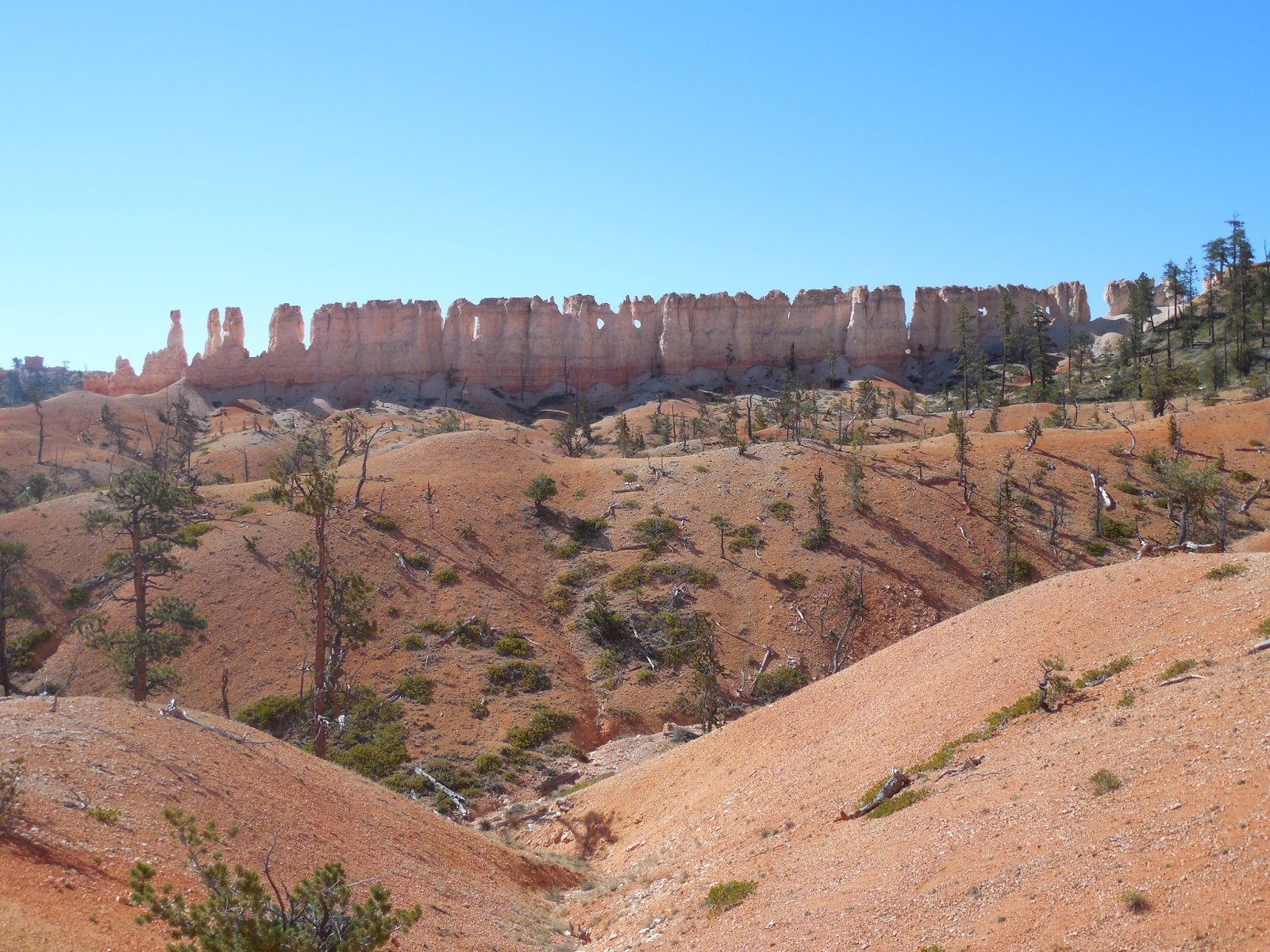
| The rugged mountains surrounding the Camino Inca. |
The next day we departed camp at 6:30, meeting a couple of pretty sociable llamas on the trail just out of camp. Llamas in the park are tagged and don't seem to be uncomfortable around people.
 |
| Hogging the trail. |
Climbing again, the trail ran along a hillside, occasionally we passed through short tunnels in the stone. We reached the ruins at Winaywayna at 2:30. This was our lunch stop as well as our camping spot for the mercifully short day, 8 hours, (after yesterday's marathon!). After lunch we explored a large ruin down below this complex. While strolling around the complex I ran into a llama that was wandering through! That evening we were treated to the sight of some beautiful lenticular clouds forming over a nearby mountain top.
 |
| Puyupatamarca, near our last camp. |
 |
| Look carefully and you'll see a llama in the ruins! |
 |
| Lenticular clouds capping a mountaintop in the waning sunshine. |
Our last day started very early, 3 A.M! This was not because we had a long walk ahead, but because the porters had to get down to the train station at Agua Caliente by 5:30! They made our breakfast and then packed up and took off.
We, however, had to walk down to another entrance gate! Apparently, the authorities don't want anybody sneaking into Machu Piccu too early. We waited for about 2 hours for the opening. we were lucky to get under a covered part of the trail since it was raining, some weren't so fortunate!
The gate finally opened at 6 and once again, we had to stop and have our papers checked! Then an hours walk, which included a stretch of stairs so steep that we had to get on our hands and knees, took us to the Sun Gate where we caught our first glimpse of Machu Piccu!
 |
| We made it!! |
At this point we started meeting people coming up from Machu Piccu. You can get to MP by bus and then stroll up to the Sun Gate for the view. There was a bit on contrast between us trekkers who had been on the trail for 4 days, and these folks, all fresh and clean!
We spent the rest of the morning and early afternoon touring around the grounds. These were all very impressive and well worth the visit, although by this time I was beginning to feel a little "Ruin Fatigue" The crowds at the site kind of diminished the magic of the place. I think I enjoyed the other ruins along the trail more, they were quiet and you could appreciate them more.
Also, I must say, for a World Heritage site of international renown, I was a little surprised at the lack facilities. There are practically no benches or seats for one to sit back and enjoy the surroundings! It seems like they want you for shuffle on through and get the heck out! Ah well. For this reason, I have come to appreciate the experience of the
Camino Inca even more. If you can physically do it, I really recommend it.
The total distance walked was about 48 kilometers, with 4 significant summits to climb. The highest elevation was Dead Woman Pass, at around 13,800 feet. Machu Picchu itself sits at
only 7872. The distances and actually climbing aren't bad except for the fact that you're already at high altitude. That's probably the biggest challenge for us lowlanders. If you can deal with the elevation, than a reasonably fit person can do this, but that is a big "IF"!
We departed MP and after a long winding bus ride, had lunch in Agua Caliente, a small town which pretty much only exists to support the tourism to the site. Kind of a ramshackle little place but with decent food. We then caught the train to Ollantaytambo, then a bus back to Cusco. Here we said goodby to Alex and Ursha and got back to el Balcon. The room we got this time was a little smaller, but still not bad.
We still had a few days left in Cusco. I had initially planned to visit Lake Titicaca, but it turned out to be impractical for our schedule. Instead, we booked a couple of day trips that ran out of Cusco.
The first trip took us to three sites just outside of town. The first was just above Cusco, overlooking the city. This was Sacsayhuaman, once a vast religious complex. Now still quite vast, despite having much of it's stone removed by the Spanish for their own use.
Most notable here was the simply amazing stonework. Look how the stones fit together in the picture below.
 |
| At Saqsayhuaman |
Next stop was an interesting site along an old Inca Trail, Tambomachay. In the Incan Empire, there was a whole network of trails for communication and commerce. Along these trails at regular distances were rest stops, (Tambos). Tambomachay was one such rest stop. This one was in pretty good condition.
 |
| Tambomachay |
Not far from Tambomachay was another Inca governmental installation, Pakapukara. This served as a checkpoint for collecting fees for transport and also housed a small force of soldiers to keep the peace.
 |
| Pakapukara |
The final stop for this "city tour", (so named because it really is just outside Cusco), was a store selling alpaca wool items. I picked up a nice alpaca sweater there for a pretty good price.
The next day we took a bus tour of the Sacred Valley, covering much the same route we took to get to Kilometer 82 at the start of our trek. First stop was the silver mining town of Pisac. We spent some time at a silversmith's shop and picked up some inexpensive silver rings while there. Then we went to the hills overlooking Pisac to see the huge terraced hillsides and, of course, more ruins.
 |
| Pisac |
Next we stopped at Urubamba for lunch. We ate at a buffet and enjoyed sampling the different dishes. We were the only people, save one, in our group who ate here, I thought that was weird, but I was glad we did.Urubamba is a hopping place and while waiting for our bus after lunch, I was fascinated by the little three wheeled taxis flitting about.
 |
| The taxis of Urubamba. |
Next stop was Ollantaytambo, now the second time we have been to this town! It is an interesting stop, with quite a dramatic view after you climb to the top of the ruins. We spent almost all of our time examining these ruins and had to hightail it back to the bus. I wished I'd have more time in this town. (On our train ride from MP after our hike, a gentleman I was chatting with mentioned he was staying at Ollantaytambo, and that it was a great little town). I'll bet it is too, looks like it would be fun.
 |
| Ollantaytambo |
We still had another stop before we got back to Cusco. We enjoyed some terrific scenery as we headed back then stopped at Chinchero. Here, besides the usual ruins, we also were entertained by a demonstration of wool crafts. I've got to say, though, that it was getting late by now and I think everyone on our tour were too tired to get real excited about it. We finally shuffled back on the bus and headed home, reaching Cusco in the dark.
 |
| Church built on Incan ruins at Chinchero |
That was just about the end of our Peruvian adventure. We had one more dinner and beer at Fuego's and prepared for the flight home.
 |
| Sacred Valley Brewing's IPA in Fuego's |
The flight home went through Houston this time, and we had to endure various security inspections and re-inspections, but finally made it back safe and sound.
This was a short trip compared to our other overseas adventures, only ten days. But I thought the hike was definitely worth the effort. Too bad Shelly was suffering from sleep deprivation, she might have enjoyed it a lot more.
I felt hiking the trail was more meaningful to me than touring MP. If taking the bus to MP is the only way you can do it, then by all means take the bus, but if you can take the physical demands, I highly recommend that you do the hike!
Got to start planning the next trip now, thinking of Hadrian's Wall!